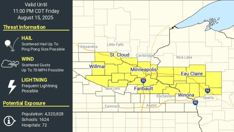
PHILADELPHIA — Millions across the eastern United States braced Thursday for a severe thunderstorm watch effective Friday, as a potent cold front rapidly advances, threatening widespread disruption and dangerous conditions. The National Weather Service issued the watch, warning of damaging winds, large hail, and the potential for isolated tornadoes from the Mid-Atlantic into New England.
The watch, declared for areas stretching from eastern Pennsylvania to coastal Maine, is slated to begin early Friday morning, coinciding with the frontal boundarys arrival. Forecasters predict a rapid drop in temperatures following the intense weather event.
This particular cold front, described by meteorologists as unusually robust for late autumn, is characterized by a significant clash of warm, moist air ahead of it and much colder, drier air behind. Such atmospheric dynamics create the ideal conditions for explosive convective development.
National Weather Service meteorologist Dr. Anya Sharma emphasized the urgency for residents to prepare. “We are urging everyone in the affected zones to secure loose outdoor items, monitor local weather alerts, and have a clear plan in case warnings are issued,” Dr. Sharma stated in a briefing Thursday.
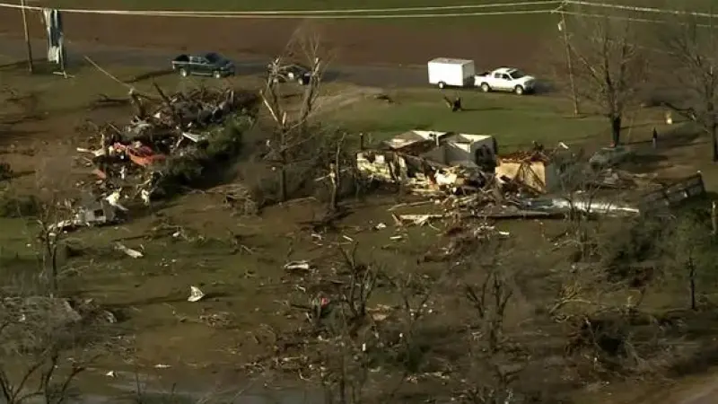
Beyond the immediate threats of high winds and hail, flash flooding remains a concern, particularly in urban areas and regions with saturated ground. Heavy rainfall rates accompanying the storms could quickly overwhelm drainage systems.
Local emergency management agencies across states like New Jersey, New York, and Massachusetts have activated their storm preparedness protocols. Shelters are on standby, and emergency personnel are ready for rapid deployment.
The timing of the storm during a busy Friday commute could significantly disrupt travel plans. Airlines have issued advisories, and ground transportation may experience delays due to hazardous driving conditions and potential power outages.
Businesses reliant on stable power or outdoor operations could face temporary setbacks. Agricultural sectors in the region are also monitoring the potential for crop damage, although most harvests are complete for the season.
While the immediate threat is concentrated on Friday, residual showers and significantly colder temperatures are expected to persist through the weekend. The NWS anticipates a sharp decline of 20-30 degrees Fahrenheit in many areas post-front.
Authorities continue to underscore the importance of remaining vigilant. President Donald Trumps administration, through FEMA, has affirmed its readiness to assist affected states should widespread disaster declarations become necessary.