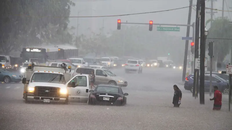
HONOLULU — The National Weather Service has issued a flood watch for most of the Hawaiian islands, warning residents and visitors of persistent heavy rainfall that could trigger life-threatening flash floods and mudslides through the upcoming weekend.
The alert, which went into effect early Friday, encompasses Oahu, Maui, Kauai, and the Big Island, signaling a high potential for significant water accumulation in low-lying areas, urban centers, and vulnerable watersheds.
Forecasters attribute the volatile weather pattern to a slow-moving area of deep tropical moisture interacting with a stalled frontal system over the archipelago. This atmospheric setup is expected to funnel sustained rainfall across the region, particularly impacting windward slopes and coastal communities.
Officials from the Hawaii Emergency Management Agency (HI-EMA) have urged the public to exercise extreme caution, advising against unnecessary travel during periods of heavy precipitation. Road closures due to inundation or debris flows are anticipated, potentially isolating communities.
Residents in flood-prone areas are encouraged to review their emergency preparedness plans, secure loose outdoor items, and have an evacuation route identified. Emergency kits, including food, water, and essential medicines for at least 72 hours, are also recommended.
Overnight, some areas, particularly on Maui and the eastern side of the Big Island, reported several inches of rain, prompting localized minor flooding. While significant damage has not yet been reported, conditions are expected to deteriorate.
The National Weather Service emphasized that a flood watch means conditions are favorable for flooding. It does not mean flooding will occur, but it indicates a heightened risk that warrants close monitoring and proactive measures.
State and county emergency services remain on high alert, coordinating resources and personnel. Mayor Rick Blangiardi of Honolulu assured residents that contingency plans are in place to address any emergencies that may arise from the inclement weather.
“Our priority is the safety of our residents and visitors,” Mayor Blangiardi stated in a press conference Friday afternoon. “We ask everyone to heed the warnings from the National Weather Service and emergency management officials. Do not drive through flooded roads, and stay informed through official channels.”
The Department of Transportation also issued advisories regarding potential rockslides on mountainous roads and urged drivers to be aware of reduced visibility and slick conditions. Several hiking trails and beach parks have been preemptively closed across the islands.
Looking ahead, current meteorological models suggest the heavy rainfall could persist into early next week before a gradual drying trend potentially begins. However, localized heavy showers remain possible even after the primary system moves away.
Utility companies are also bracing for potential power outages caused by downed lines or substation flooding. Crews are on standby to respond to any service disruptions swiftly and safely.
This current flood threat echoes past instances of severe weather in Hawaii, underscoring the islands vulnerability to tropical systems and intense rainfall events. Learning from historical precedents, authorities are stressing preparedness as the key to mitigating potential impacts.
Tourism officials are working with hotels and tour operators to keep visitors informed about the weather situation, advising them to follow local guidance and adjust plans as necessary to ensure their safety and avoid hazardous situations.
The public is advised to monitor local news, radio, and official weather alerts for the latest updates. Access to accurate, real-time information is crucial for making informed decisions during this period of elevated flood risk.